

After confirming the project with the work’s artist, Bob Altwein, I am now set to begin reprinting 100 Year Rip-Off within the next two weeks!
An exciting add-on to this momentous occasion (my first experience with “printing”/”publishing”) is some supplementary information that I’m providing within this graphic history of British Columbia.
- Click to enlarge

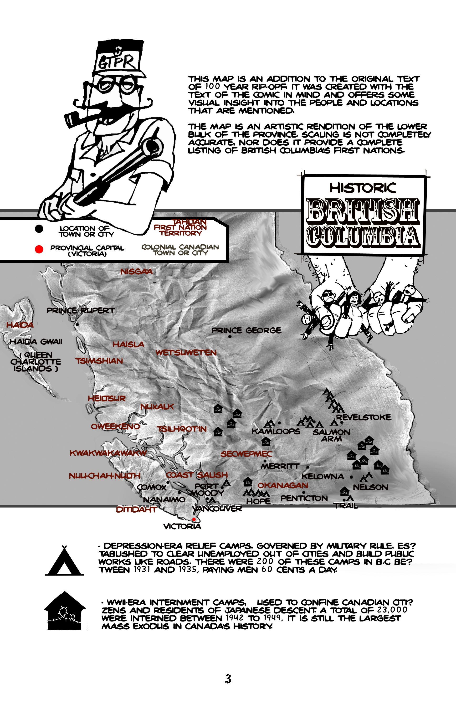
Posted here is an “Historic” Map of B.C. that I’ve drawn. It includes the territories of First Nations in the province; relief camps during the 1930’s, which were hotbeds of squalor and social unrest; and finally, the locations of B.C.’s 15 WWII-era internment camps, where thousands of Canadian citizens and residents of Japanese descent were held against their will. It was the largest mass exodus in Canada’s history.
Needless to say, I was a bit surprised that even this basic information (the numbers and locations of these camps around B.C.) necessitated several hours at the Toronto Reference Library. You think everything is on the internet… until you want to investigate history in detail.
While the map is located on page 3 of this 30-page comic book, I have also added a glossary of names and terms to the back, for those outside of B.C. who may not immediately understand that B.C. Hydro is our public electricity company, or that the I.W.W. stands for Industrial Workers of the World.
I look forward to your feedback! If this is up your alley, then stay tuned – #100Year Rip-Off will be available for purchase as a 30-page comic book in July 2013!
